Maps and Basemaps
A project holds one or more maps (Insert › New Map), each with its own layers, basemap, projection, bookmarks and view settings. Maps open as tabs above the map view.
Navigating
Drag to pan and scroll to zoom; Home (or Full Extent) shows all the data. Map › Navigate has fixed zoom steps, Previous and Next extents, Bookmarks (the World Atlas has World, Europe, Africa, Americas and East Asia) and Go To XY, which pans to a longitude and latitude. Type a scale in the status bar to jump to it. More navigation tools are under View effects below.
Basemaps
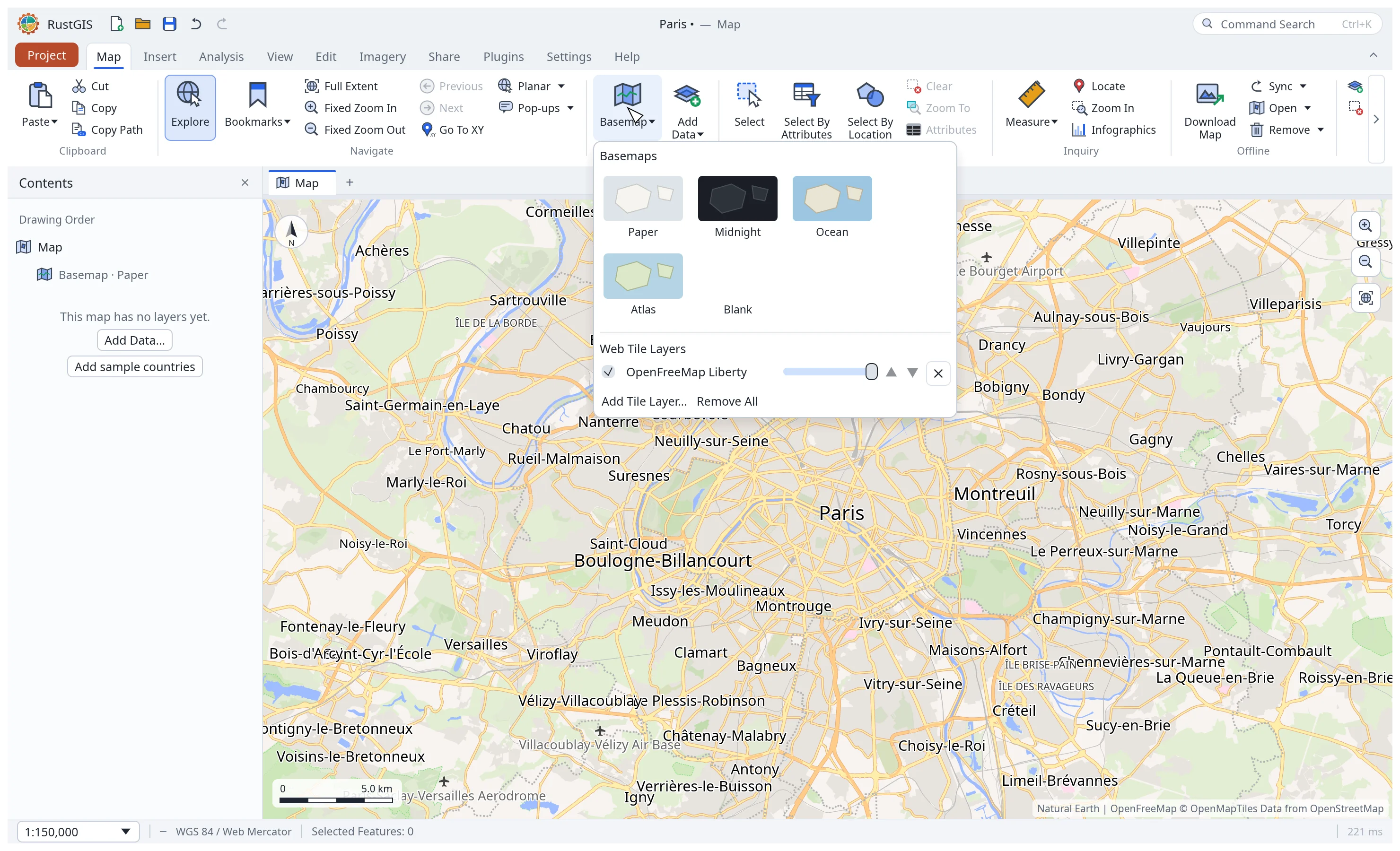
Map › Basemap offers five built-in basemaps drawn from a world outline (Paper, Midnight, Ocean, Atlas, Blank), which need no network, and web tile layers over them:
- Raster tiles from an XYZ or TMS template (
https://…/{z}/{x}/{y}.png;{-y}for rows from the south,{s}for subdomains,{q}for Bing-style quadkeys) or a WMS through{bbox-epsg-3857}. PNG, JPEG and WebP. - Vector tiles (Mapbox Vector Tiles,
.pbf) from a template or a TileJSON address, drawn in a built-in style that knows the OpenMapTiles, Protomaps and Shortbread schemas. - PMTiles archives (
.pmtiles) of raster or vector tiles: a web address, read a tile at a time by byte ranges (the server must allow range requests, and CORS for the web app), or on the desktop a file (PMTiles File…, Add Data, or drop it on the window). A vector archive that is a basemap is drawn in the built-in style; any other is drawn with each of its layers in a colour of its own. - Map styles: a MapLibre style document (
style.json), with its vector and raster sources. RustGIS draws background, fill, line, circle and raster layers, point labels with their icons from the style's sprite (SDF icons in theiricon-color), and fill patterns; it evaluates the style's expressions and zoom functions. Line labels and shields along roads, line patterns, hillshade and 3D extrusion are not drawn (extrusions draw flat). A label shows the lines of its text that the map's font can draw: a style's "Syria / سوريا" shows as "Syria".
Add one with Add Tile Layer… at the bottom of the Basemap gallery, or install the Basemaps plugin for a tab of public basemaps. The gallery lists the map's tile layers: show or hide them, change their opacity and order, or remove them. Overlays (labels, roads) stay on top of the basemaps; choosing a built-in basemap removes the web basemaps but keeps the overlays. Tile layers are saved with the project, and their credits are shown in the corner of the map and drawn on exports.
Tiles load in the background and the map fills in as they arrive, with coarser tiles standing in
meanwhile; exports and rustgis-cli wait for them. On the globe and in other projections the
tiles are reprojected. From scripts: map.addTiles, map.removeTiles, map.setTiles and
map.tiles.
Worldview
The world outline and the World Atlas sample's countries come in two worldviews: Natural
Earth's default borders, and China's (Natural Earth's China point of view: Taiwan, Aksai Chin
and South Tibet are part of China). RustGIS picks China's when the system's time zone is
mainland China's (such as Asia/Shanghai) or its first locale is zh-CN; nothing is looked up
over the network. Choose one in Settings › Language › Worldview, set RUSTGIS_WORLDVIEW
(default or china), or pass --worldview to rustgis-cli. An untouched sample project
switches its countries at once; others keep the layer they have.
Projections
The flat map is drawn in Web Mercator by default. View › Projection switches it to another
projection, and clicking the coordinate system in the status bar opens the Coordinate
System dialog, which also takes any projected EPSG code (such as 3035, 32633 for UTM zone
33N or 2056 for Switzerland):
| Preset | Kind |
|---|---|
| Equirectangular, Miller | World, cylindrical |
| Mollweide, Lambert Cylindrical Equal Area, Equal Earth, Eckert IV | World, equal-area |
| Robinson, Natural Earth, Winkel Tripel | World, compromise |
| North / South Polar Stereographic | Polar |
| Europe Equal Area (ETRS89 LAEA), USA Contiguous Albers Equal Area | Regional, equal-area |
Layers are projected on the fly. Each projection has an area of use: polar projections show
their hemisphere poleward of 30°, regional ones their region, transverse Mercator (UTM) zones
30° either side of their meridian, and data outside it isn't drawn. Switching keeps the centre
and scale, and the choice is saved with the map (map.projection from the command line). A
raster already in the map's coordinate system draws without being reprojected. Robinson, Equal
Earth, Natural Earth, Winkel Tripel and Eckert IV are computed by RustGIS itself on a sphere,
so EPSG:8857 (Equal Earth) works too.
Globe
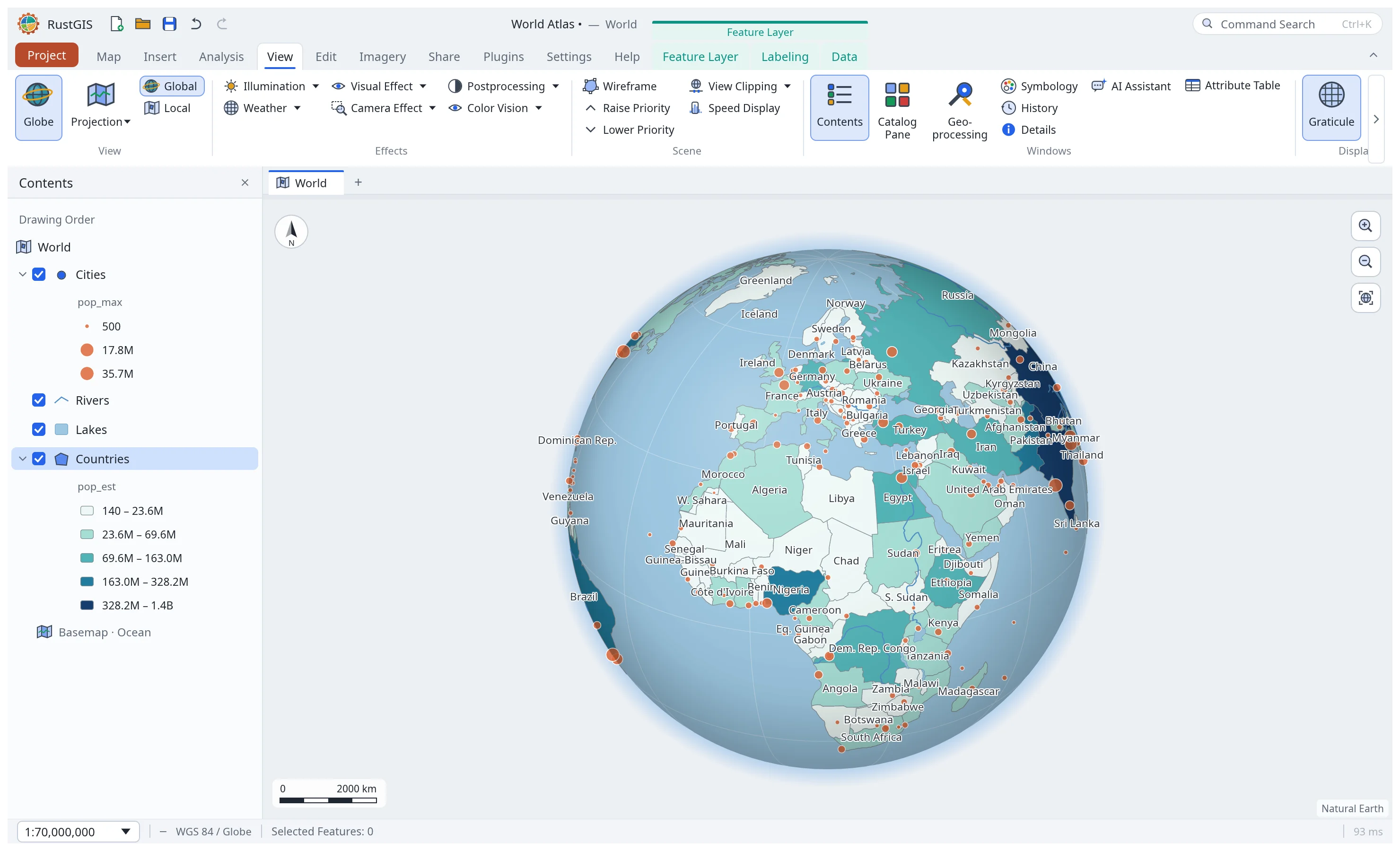
View › Globe shows the map as a 3D globe seen from space instead of the flat Web Mercator
map, and back again. Drag to turn the globe, scroll to zoom, and use Full Extent to see the
whole Earth. Every layer draws on the globe: vectors are clipped at the horizon and follow great
circles, rasters are draped onto the sphere, and labels, selection, identify, measuring and
editing work as on the flat map. The scale stays the same when you switch, and the choice is
saved with each map in the project (map.projection from the command line).
View effects
The View tab adds effects drawn over the map: Illumination (day and night shading for a time, with twilight), Weather (haze, fog, rain, snow), Visual Effect (vignette, edges), Camera Effect (tilt-shift blur, film grain) and Postprocessing (brightness, contrast, saturation, sepia). The Color Vision simulator shows the map as people with protanopia, deuteranopia, tritanopia or achromatopsia see it (on screen only; exports are untouched).
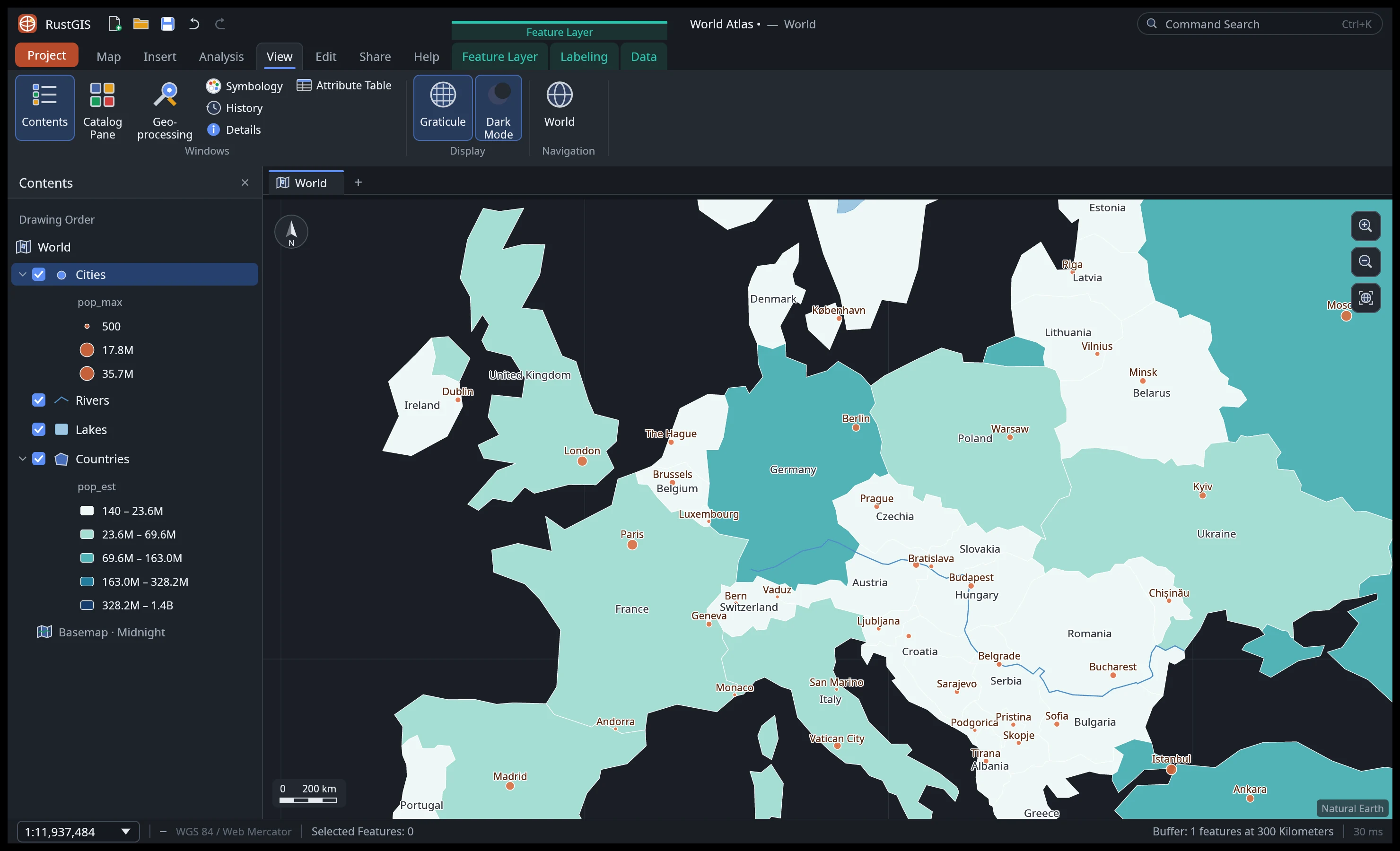
Global shows a globe; Local a flat view centred where you are (azimuthal equidistant). Wireframe draws polygons as outlines, Depth Priority lifts a layer above others whatever its order, View Clipping hides features beyond a distance from the centre, and Speed Display draws without antialiasing. The Navigator adds a compass, zoom buttons and a pan pad; Camera shows and sets the position and scale; the Magnifier shows twice the map under the pointer. On the Map tab, First-Person navigation walks with W A S D and flies up and down with Q and E. View › Display › Dark Mode switches the whole interface to a dark theme.